


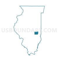
MATTOON 6-2 Voting District, Coles County, Illinois
About
Outline

Summary
| Unique Area Identifier | 564992 |
| Name | MATTOON 6-2 Voting District |
| County | Coles County |
| State | Illinois |
| Area (square miles) | 0.32 |
| Land Area (square miles) | 0.32 |
| Water Area (square miles) | 0.00 |
| % of Land Area | 100.00 |
| % of Water Area | 0.00 |
| Latitude of the Internal Point | 39.49178460 |
| Longtitude of the Internal Point | -88.38685620 |
Maps


Graphs
Select a template below for downloading or customizing gragh for MATTOON 6-2 Voting District, Coles County, Illinois


Neighbors
Neighoring Voting District (by Name) Neighboring Voting District on the Map
- MATTOON 5-2 Voting District, Coles County, IL
- MATTOON 6-3 Voting District, Coles County, IL
- MATTOON 7-1 Voting District, Coles County, IL
- MATTOON 7-2 Voting District, Coles County, IL
- MATTOON 8-1 Voting District, Coles County, IL